

Serve the exploration department
- – Staking of well location (Rig Positioning) in Onshore and offshore by GPS.
- – Construction Permanent Markers (P.M.) and seismic lines for seismic Surface survey 2D & 3D.
- – Quality Control (Q.C.) for Seismic Survey Positioning (Onshore) and Marine Seismic Survey Positioning (Offshore).
- – Staking of Vertical Seismic Profiles (VSP) points.
- – 2D survey AS-Built drawing for process pipelines and concession.
- – Convert data coordinates from datum to datum.
- – Mine clearance survey route by GPS.
Serve the Project department
- – Establishment a Global Positioning Services (GPS) network.
- – AS – Built drawing for road details.
- – Staking out the axis of pipelines route.
- – 2D survey AS-Built drawing for process pipelines and concession.
- – Cadastral & Topographic survey map.
- – Grid leveling.
- – Setting out and As-Built map for water & drainage lines and Road.
- – Calculation of volume of cut & fill.
- – Flattening & preparing of land.
- – Ordinary & precise leveling.
- – ELongitudinal & cross sections leveling.
- – Engineering’s supply.
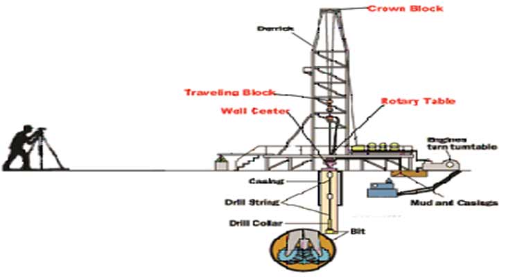
Serve the Drilling department
Derrick or/and rig alignment Inspection.