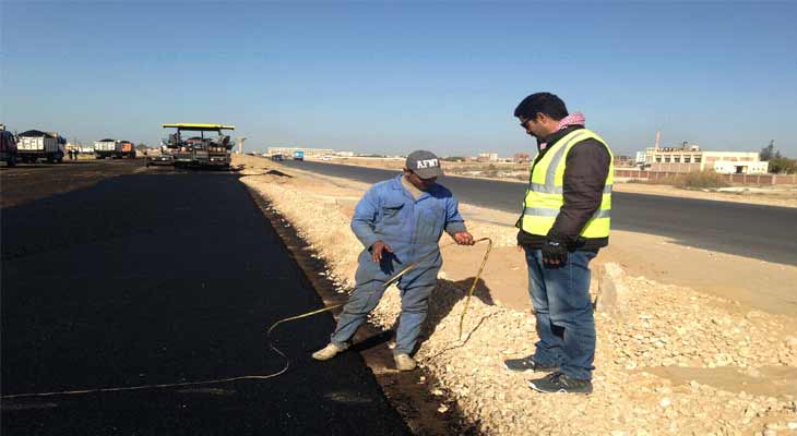

For Road
Our technical engineers and surveyor supervision the follow all stages of road construction of Control points, Drilling, Leyar levels, Road widths, Directions, quantities to achieve design.

Quality Control (Q. C.) for Seismic Survey Positioning
- – Q.C. On Survey Equipment
- – Wooden Stake
- – Cadastral Maps (AS-Built Maps)
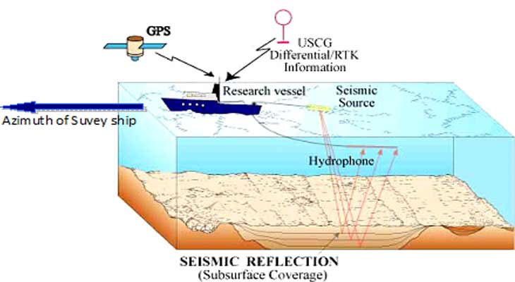
Quality Control (Q. C.) for Marine Seismic Survey Positioning
ESM consultants are available for marine seismic surveys positioning to ensure effective operations and high quality of acquired data according to survey technique utilize
During the project run the Q.C. man will observe the following:
- – Field survey technique will use, such as “DGPS system, Transformation Parameters, Correction system, Satellite navigation data”.
- – Marine Survey equipment’s.
- – Azimuth of survey lines requiring shooting.
- – Survey Product data quality.
- – Field survey data download to product drawing map through AutoCAD survey progress.
- – Q.C. Engineer will send daily report to client main office to descript the survey operation statues.
- – ESM was co-operated with LUKOIL Petroleum Company on West Geisum and North East Geisum concession areas at Gulf of Suez in Q.C. for marine seismic survey.